Mining Claims
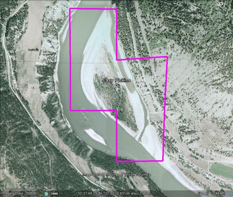
Easy Pickins
|

CARIBOO DISTRICT - Fraser River
Articul Tenure #996203
Location and Licenses
| Central Coordinate 122° 22' 13.0" W Longitude 52° 21' 52.0” N Latitude |
| 4 cell tenure – 78.95 hectares (195.0 acres) |
| Price: $ 2,958 plus 5% royalty |
The Easy Pickins placer claim overlies an island on the inside bend of the main-stream flow of the Fraser River, which during low water periods its gravel bar connects it to the main land mass on the east side of the river. This property offers 1½ kilometres by 450 metres of gravel/cobble beach and shoal, with the island itself extending slightly over 600 metres in length. During the 2005 sampling program along the Fraser whence sampling was engaged along this area, the river’s water level had not receded sufficiently enough to create that natural land-bridge, therefore, the actual island and adjoining bar itself has not been sampled, however, the beach running immediately to the south of the channel (within the claim’s bounds), received limited pan sampling – whereas favorable results were realized for the amount of time spent at this tenure. The extent and distribution of placer minerals was not determined at that time. The annual rise and fall of the Fraser River refreshes with new deposit. For the boating placer operator, this would extend the recovery season.
Access to the property is gained via the “Soda Creek Townsite Road”, situate along Highway 97 at coordinate 122° 16' 43.56" W Longitude, 52° 21' 19.11” N Latitude.– 31 kilometres north along Williams Lake, from said highway’s junction of McKenzie Avenue North, on the north end of Williams Lake. Said Soda Creek Road strikes south then curves back northwestward until it terminates at a “T” junction with Macalister Road, thence turning westward (right) and following said road to the tenure area.
Similar Properties


