Regional Geology
+ click on image to view enlarged
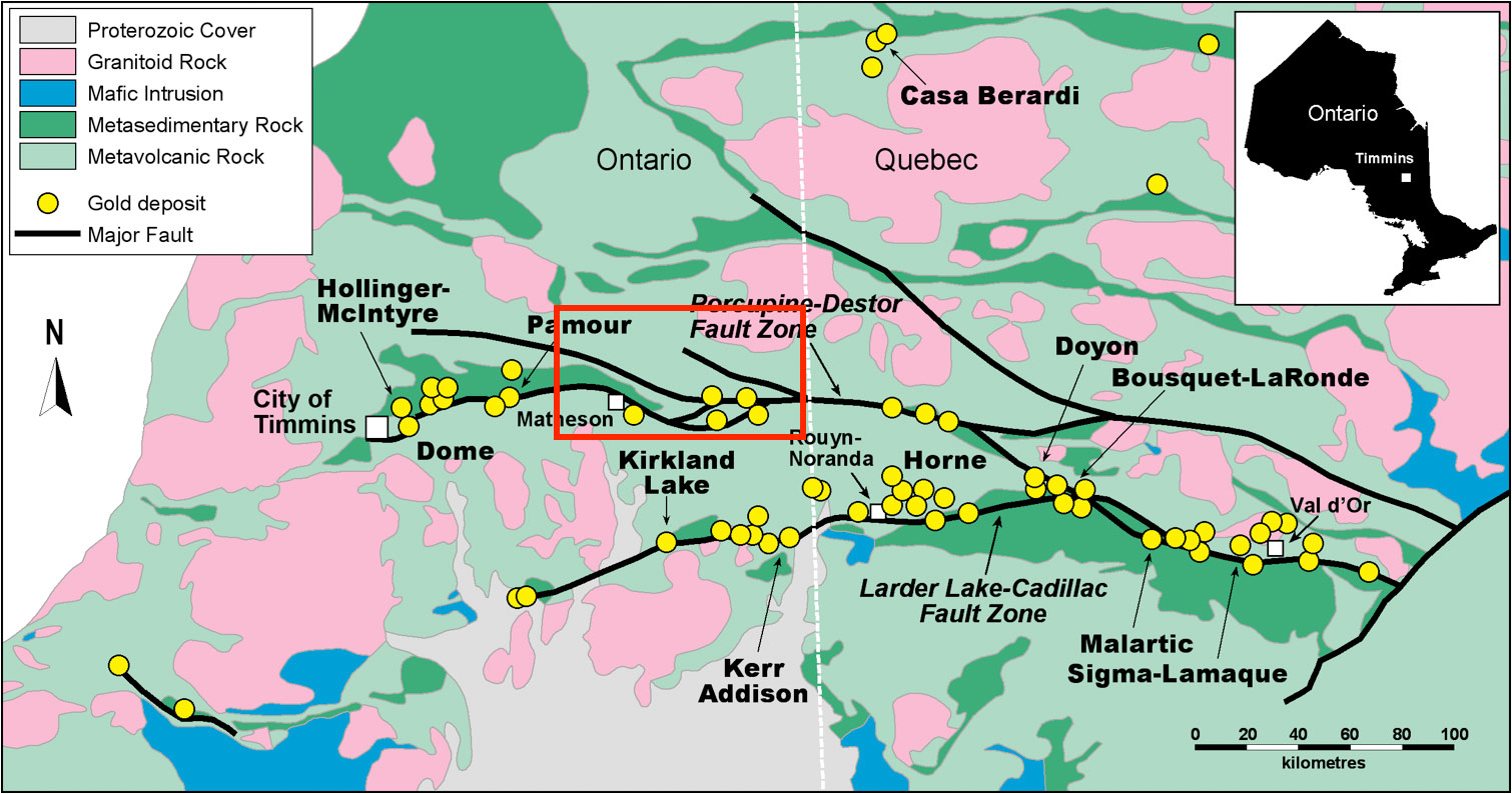
SAS properties in Timmins are centrally located in the Abitibi Greenstone Belt ("Abitibi Belt"), in the Superior Province of the Canadian Shield. The Abitibi Belt is the largest Archean (i.e. greater than 2.5 billion years old), belt of its kind in the world, and is also one of the most prolific in terms of mining production. It is a 750 kilometre long by 250 kilometre wide belt of deformed and metamorphosed volcanic and sedimentary rocks and granitoid batholiths ranging in age from approximately 2,745 to 2,680 Ma (Ma is defined as millions of years).
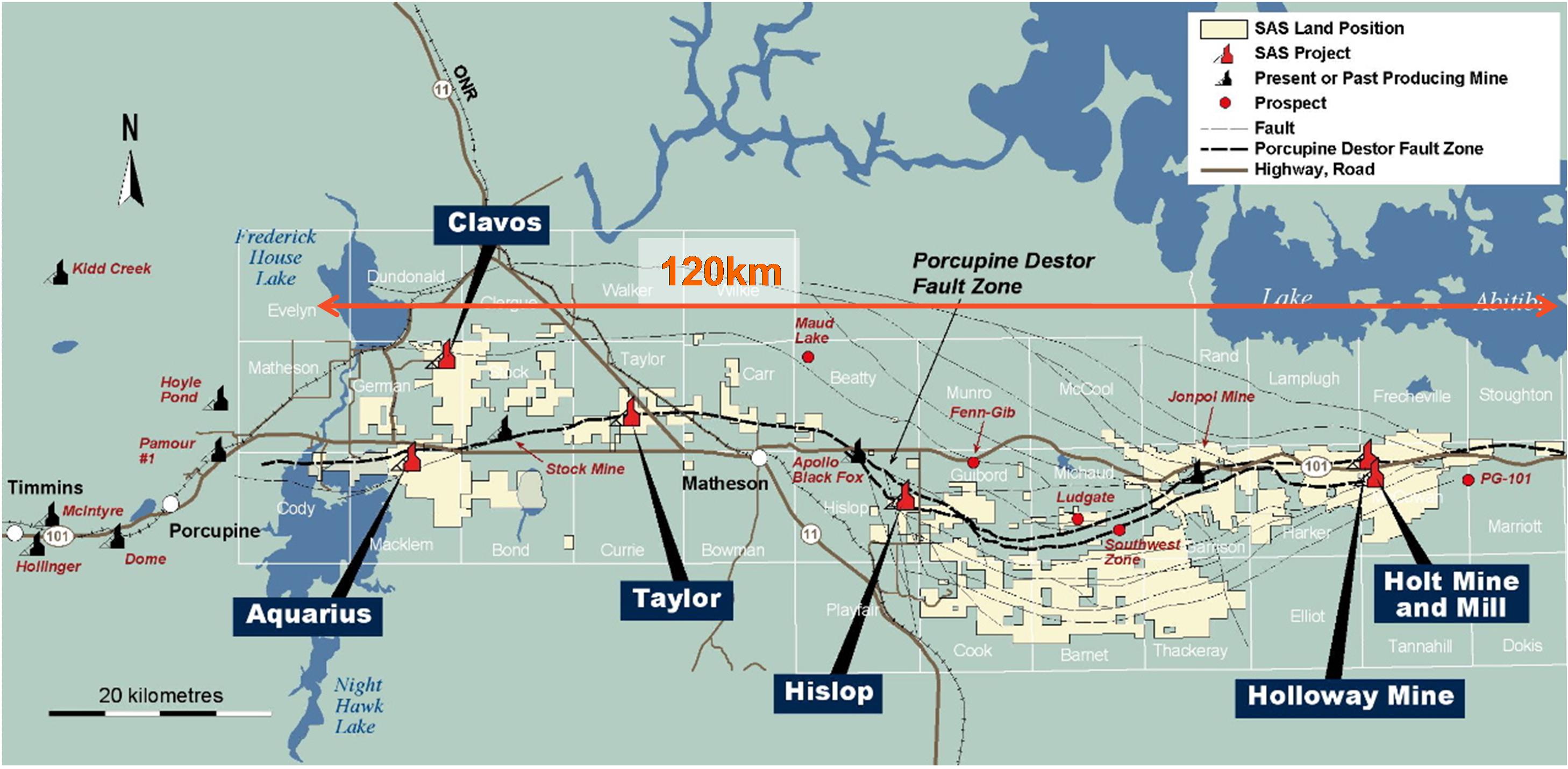
The major structural features in the area are the Porcupine-Destor Fault Zone ("PDFZ") and the Pipestone Fault. Gold deposits are commonly localized within and proximal to the PDFZ along its 450 kilometre length west of Timmins through to the Matheson area and eastward beyond the Val d'Or area of Québec. The fault zone was recognized in the early 1900's with the discovery of the gold deposits in the Timmins area (see "History of Timmins"). Numerous gold deposits occur in the vicinity of the PDFZ and related structures such as the Pipestone Fault. These include the major mines of the Timmins camp, such as the Dome, Hollinger, McIntyre, Pamour and Hoyle Pond mines.
Deposit types and exploration models can generally be characterized as one of three main types, although they tend to merge with each other at times. The different deposit types may have more to do with the different host rocks than a genetic difference. Proximity to the main break(s), associated splays, presence of hydrothermal alteration, Timiskaming sediments or high level porphyries are common to all. The three main types are as follows:
• Green Carbonate Hosted: Nighthawk Lake, Aquarius, Stock, West Porphyry and Glimmer all fall into this classification. Gold is generally present as free gold in quartz veins or with disseminated sulfides associated with small intrusive rocks or albitic alteration in completely carbonate altered ultramafic flows. Carbonate alteration is up to 200 m wide and can be traced for thousands of metres discontinuously on strike. The gold is often in cross cutting or conformable features. Timiskaming conglomerates are often proximal or part of the package.
• Felsic Intrusive Related: Ronnoco, Pominex, parts of the Taylor Shaft and Hislop are examples of this type. The intrusive rocks vary from feldspar (plus or minus quartz) porphyry in the west to more syenitic in the east. Mineralization is characterized by both thin cross cutting to stockwork quartz veins to disseminated sulfides to more contact skarns or hornfels, depending on host rock. Carbonate alteration is still quite common in the host rocks with silica, sericite and hematite more within the intrusive.
• Mafic Volcanic Hosted: Harker-Holloway, Holt-McDermott and Hoyle Pond are examples. Ubiquitous carbonate alteration with iron carbonate, albite, silicification and sericite more proximal to ore. Quartz veins and/or albitized variolitic mafic flows are often central to the zone and often found near the mafic/ultramafic contact.
Along the PDFZ, over 110 million ounces of gold have been produced. A similar structure to the south, namely the Larder Lake Cadillac Fault Zone, extends west of Kirkland lake to Cadillac with gold production in this area totalling approximately 70 million ounces of gold.
Within the Company's extensive land package extending over a linear distance of approximately 120 kilometres east of Timmins, Ontario and up to the Quebec border, SAS has the opportunity to continue to add to the prosperous future of this renowned mining district.
+ click on image to view enlarged
Source: http://www.sasgoldmines.com/s/RegionalGeology.asp
|