Land Surveying & Geomatics
(Temiskaming Shores, New Liskeard, Haileybury, and beyond)
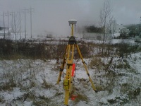 Land Survey
• Boundary surveys
• Precision layout
• Reference plans (easements)
• Plans of Subdivision
• Crown Land Surveys
• Mining leases
• Surveyor’s Real Property Reports
 Control Survey
• Horizontal / Vertical Control Networks (air-photo control, project control, etc.)
• Precise positioning (boreholes, monitoring wells, test pits, etc.)
• Precise Monitoring (deformation, subsidence, differential settling)
Planning & Development
• Combination Boundary & Topographic plans of Survey
• Pre-engineering surveys for design
• Lot Grading plans / Conformance
• Sketches & plans of survey for consent applications (severances,
easements, etc.)
• Subdivision / condominium applications, plans
• Mapping subsurface utilities
Research
• Title Searching
• Estimates Research
• Plans / Opinion Research
Miscellaneous
• Topographic Survey & for Quantities
• Title Record Plans / Sketchs
• GIS / database
Source: http://www.storyenvironmental.com/land-surveying--geomatics.html