Eagle Mapping
LiDAR
Bare-Earth DEM
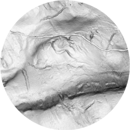
A ‘bare earth’ ground model is the backbone of digital mapping for engineering, resource exploration, drainage modeling, etc.
Full Feature DSM
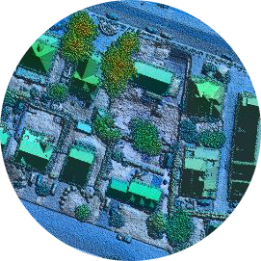
A ‘full feature’ surface visualizes the highest surface including all features above-ground. This will include buildings, vegetation, power lines, and many other features.
Canopy Height Model
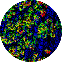
Quickly calculate tree volumes, or measure growth with repeat mapping over time for harvesting or conservation planning.
Intensity Imagery
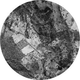
Our LiDAR systems record 16-bit intensity, providing fantastic feature definition for analysis and base mapping.