Timbercraft Consultation Inc.
Professional Aerial Mapping
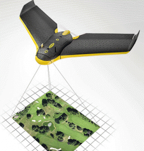
Timbercraft is pleased to offer the services of our SenseFly eBee Unmanned Aerial Vehicle (drone). Call us for the most precise map, created with cutting-edge mapping technology.
Collects aerial photography of 1-10sqkm in a single flight at down to 5cm precision.
The eBee has a flight time of up to 50 minutes allowing to cover areas of up to 10sqkm in a single flight. With its 16MP camera it can shoot aerial imagery at down to 1.5cm/pixel resolution. The images can then be used to create maps and elevation models with a precision of 5cm.
Source: http://timbercraftconsultation.com/professional-aerial-mapping/
Magazine
No information