Galleon Gold Corp.
West Cache Gold Project
The Property
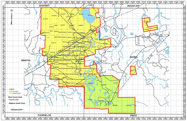
The West Cache Gold Project (formerly known as the Timmins Porcupine West Project) is located in Bristol and Ogden Townships in the Porcupine Mining Division , District of Cochrane, Province of Ontario. The property consists of 265 unpatented mining units and 3 patented mining claims located in the Bristol and Ogden Townships in the Timmins-Porcupine Mining Camp for a total 3,200 hectares. The property is bisected by highway 101 and can be accessed from the city of Timmins located 13 km to the east. The property is contiguous to the Timmins West Mine (now owned by Pan American Silver) where West Timmins Mining Inc. (WTM) intersected 83.40 meters (273.55 feet) grading 12.75 g/t (0.37 oz/t) in 2009. (WTM Press Release June 24, 2009).
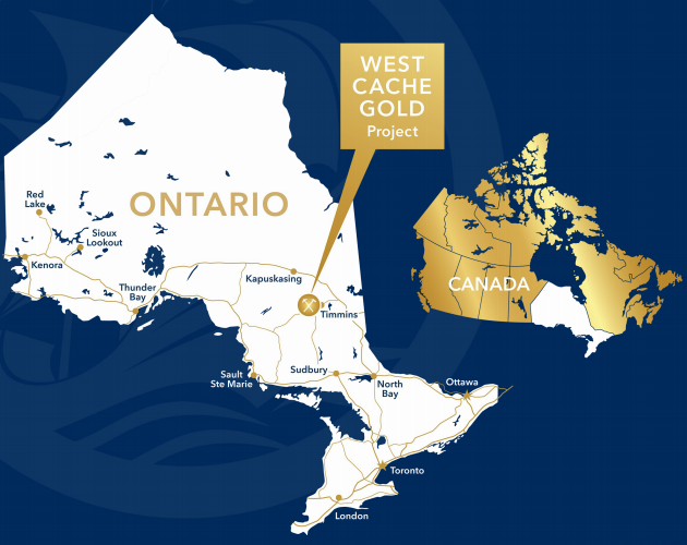
West Cache Gold Project Map
History and Geological Background
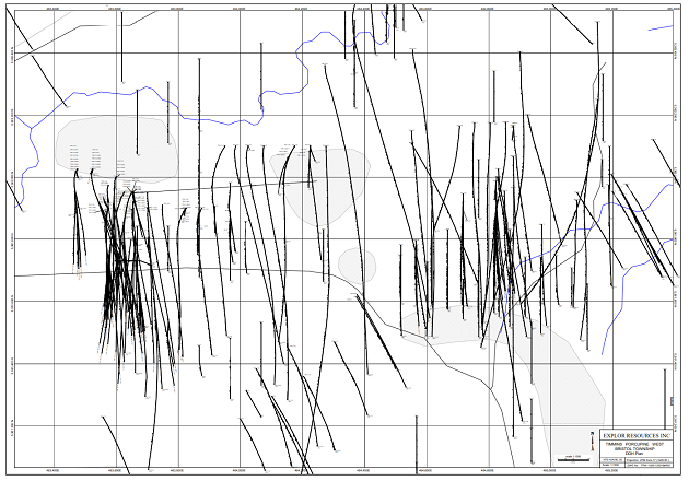
The property has been explored since 1927 by numerous ground geophysical surveys and diamond drilling of up to 111 holes. In 1984, Dome Exploration discovered and delineated a gold mineralized zone that is approximately 350 meters long and 45 meters wide. The zone strikes east northeast and dips to the north at 70 to 80 degrees. Drill programs by Teck Corporation, Cameco Gold and Tom Exploration Inc., have extended the mineralization to 350 meters of depth. Explor Resources (now Galleon Gold) intersected gold mineralization in 121 out of 126 holes drilled and in 64 out of 65 wedges.The gold mineralization to date appears to be associated with a major porphyry unit.
It is important to note that the strike length of the gold mineralization is greater than 2000 meters at depth. The continuity of mineralization continues to be confirmed and the structure remains open on strike and at depth.
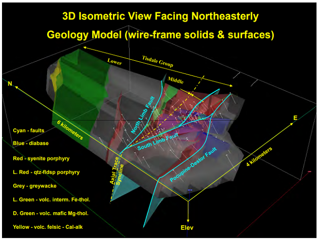
The most significant deposits in Timmins are spatially associated with porphyry units that are in proximity to the Porcupine Destor Fault. The deposits appear to be also associated with splay faults that trend off to the North of the Porcupine Destor fault inside an interpreted splay fault corridor as shown on the attached plan.
The West Cache Gold Project has as a Target Model “The Hollinger-McIntyre-Coniaurum System.” The Hollinger-McIntyre-Coniaurum (HMC) System has produced a total of over 30 million oz of gold is spatially associated with the Pearl Lake Porphyry. The high-grade gold bearing quartz veins which hosted the bulk of the gold at the HMC occurred in the adjacent mafic volcanics, located outboard from the porphyry itself.
Source: https://galleongold.com/projects/west-cache-gold-project/

|