Eagle Mapping
Geology
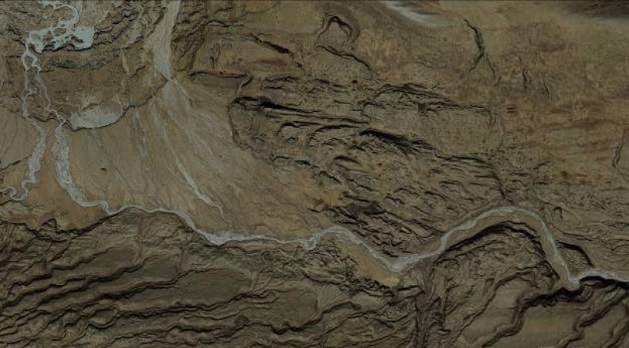
Exploration Geologists use accurate topographical and orthophoto maps, usually at 1:5000 scale with 5 meter contours, as a base for geological mapping and for determining where to locate drill holes.
Exploration geology is the key to discovering mineral deposits for new mines. In order to find new ore deposits the geologist must use a variety of technological tools such as airborne geophysics and digital topographical and orthophoto mapping.
It is imperative that the geologist has an accurate and detailed topographical and/or orthophoto map on which to develop his geological map. This base map usually has other data and plan features added to it in order to aid the geologist in identifying structures or anomalies that tend to indicate the possibility of an ore deposit. LiDAR, bare earth mapping becomes a valuable tool in the hands of an experienced geologist who is trained to see features that become evident once the data that represents anything above ground is removed.
The elevations and stratigraphy shown on the base map created from the LiDAR and aerial photography will greatly assist the geologist in preparing a better geological map which in turn will help locate more precise drill holes.
When Canadian mines are submitting a 43-101 assessment topographic mapping is a required part of the documentation.
Accurate topographic mapping from LiDAR is used in three key areas of mine location and development. It is first used by geologists to locate a viable ore deposit, then to precisely locate the positions for sampling core, drill holes. It is then used as a part of the approval process required from regulatory bodies. Once a mine has been approved the engineers use this same data to plan infra structure, roads, electrical corridors, tailings ponds and supporting services.
LiDAR Applications
Because LiDAR data provides extremely accurate georeferenced information it can be used to exactly determine:
• Where the faults and stratigraphic features are on the property
• A very accurate surface model to generate 1 Meter contours and to orthorectify any aerial imagery
• The LiDAR DEM will show old mine workings and roads that may be hidden in forested areas
PHOTO applications
Accurate orthophoto maps can be used to determine a variety of factors that require pictorial references.
They include:
• Assist the geologist in locating himself in the field
• A base on which to outline the geological rock types on the property
• Help with creating a practical and cost effective presentation to management regarding the exploration program planned for the property.
Source: http://www.eaglemapping.com/industry/mining/geology