AuRico Gold

El Chanate

Oct 15, 2014


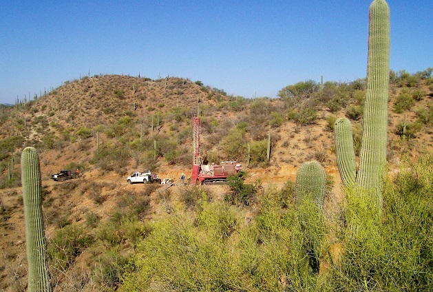
AuRico Gold’s El Chanate Mine is located 37 km northeast of Caborca in Sonora State, Mexico. The Mine consists of an open pit, crusher, heap leach pads, and process plant located on 3,665 hectares encompassed within 19 mineral concessions. Since acquiring El Chanate in April 2011, the mine has consistently delivered solid results. During the year, El Chanate reported production and cash costs results that were in-line with guidance levels. 
 
In 2014, El Chanate is expected to deliver another year of solid operational performance within expected production and cash costs estimates. The 2014 exploration program will focus on three mineralization targets along the Chanate fault with a goal to increase resources and potentially extend mine life.

Historical workings suggest the area has been mined for gold since the early 19th century. The current open-pit mine has now been developed below the level of those historical small-scale mine workings.The open-pit mine plan covers an area approximately 1,700 metres long, 780 metres wide, and 280 metres deep. El Chanate utilizes conventional three stage crushing and heap leaching, with gold bearing solutions being processed in an ADR plant, followed by electro-winning and refining.

Geology
El Chanate’s main structural feature is the Chanate fault zone, a 7 km-long northwest-striking, variably southwest-dipping structure. The area is underlain by deformed sedimentary rocks of the Late Jurassic-Early Cretaceous Bisbee Group and the Late Cretaceous Chanate Group, which locally are overlain by andesites of the Cretaceous El Charro volcanic complex.
 
The sedimentary strata are locally intruded by andesitic sills and dikes, a microporphyritic latite, and a diorite stock. These strata comprise mudstone, siltstone, sandstone, conglomerate, shale, and limestone.
 
Sandstone, conglomerate, and lesser mudstone that lie above the Chanate fault are of the Middle Cretaceous Chanate Group. Below the fault, siltstone and sandstone lenses are assigned to the Arroyo Sasabe Formation of the Lower Cretaceous Bisbee Group.
 
Mineralization
Alteration and mineralization associated with the Chanate fault zone are exposed across a northwest strike length of over 3.5 km. The rock units in this zone are altered to varying degrees by sericite, pyrite, ankerite, and quartz veining.
 
In surface outcrops the mineralized zone is distinguished by its bleached appearance relative to unmineralized rock. Sub-parallel sheeted zones of quartz veinlets form thick, mineralized lenses, within a larger area of sub-economic but anomalous gold concentrations.
 
Drill-hole data indicate the mineralized lenses are sub-horizontal to gently southwest-dipping, and are often parallel to the Chanate fault and the steep normal faults. The Chanate fault zone itself is generally weakly mineralized, while rock units in the adjacent hanging and footwalls are well mineralized.
 
Exploration
The 2014 exploration program is focused on further defining mineralization within the existing open pit and expanding the known mineralization along the Chanate trend with a goal to increase resources and potentially extend mine life.
 
The drilling program within the current open pit has intersected a new type of mineralization below the ultimate open pit floor, which is significantly higher in grade than the current reserve grade and is hosted within a strongly silicified siltstone adjacent to a fault structure. 
 
Outside the open pit, the drilling program is focused on three targeted areas along the Chanate Fault:
• The North West Extension area, located 50 metres northwest of the ultimate open pit design, where 24 of 26 holes intersected grades that are equal to, or exceed, current cut-off grades;
• The Rono target area, located 600 metres northwest of the ultimate open pit design, where 19 of 23 holes drilled in 2012 and 2013 intersected a broad zone of gold mineralization with grades that are equal to, or exceed, current cut-off grades; and
• The Loma Prieta target area, located 1.2 kilometres southeast of the ultimate open pit, where 11 of 18 holes have intersected a quartz vein structure with grades that are equal to, or exceed, current cut-off grades.

Source: http://www.auricogold.com/operations/el-chanate/default.aspx

MILL PLANNER

Reporting to the Mill General Foreman, the Mill Planner is responsible for planning and scheduling mill mechanical maintenance, shut down and project work, collaborating with the Electrical and Mobile Planners, Mill Supervisors, Operators, Millwrights and Process Engineers.

Director, Sustainability

The Director, Sustainability is responsible for supporting and executing Alamos’ company-wide sustainability strategy with a focus on environmental aspects including, regulatory compliance, environmental permitting as well as stakeholder and community engagement.

Geologist (Core Logger)

Reporting to the Sr. Exploration Geologist, the Geologist will focus on carrying out exploration programs related to geological mapping, geochemical sampling programs, geophysical surveys and drilling and to ensure service and/or operating standards are met (internally and/or externally).