Advanteck UAV/Drone Services
UAS Services
Aerial Photography
Advanteck provides low altitude, high resolution aerial photography and aerial videography. Our multirotor UAV platform offers a cost effective alternative to manned aircraft for a variety of field applications. Located in the North our pilots and Geomatics specialists are working in the same community and can readily provide services.
Digital Surface Models (DSMs)
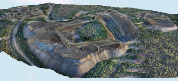
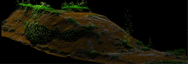
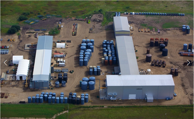
DSM’s and densified point clouds can be used to take accurate measurements for damage assessment, precise volume measurements for aggregate resource management and open pit mining..
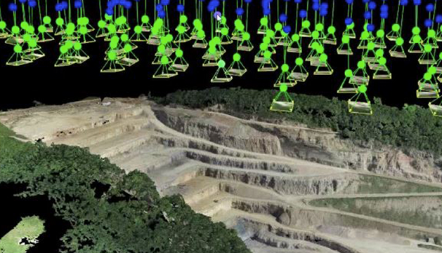
Pix4Dmapper image of photo mosaic and the camera positions
Aerial mosaic and volume estimation of mine overburden
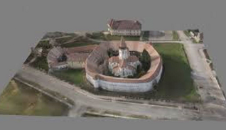
3D Textured Point Clouds can be used in architecture and building assessments as well as mine tailing stockpile management.
Mining Volumetric Surveys
3D Modelling
Photogrammetry 3D Modelling tools are used to create 3 dimensional structure
3D Textured Point Clouds can be use in architecture.
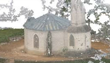
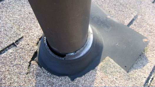
Roof Inspections
3D Textured Point Clouds can be use in architecture.
Aerial Inspections
Aerial video and/or still imagery can provide detailed information on the status of infrastructure. Aerial inspections are also used to monitor construction projects in remote areas like dams or mines.
Roof Inspections
Close-up colour 4K images are a quick, safer and less expensive way to evaluate roofing conditions in order to determine the degree and even whether or not further intervention is required.
Bridge Inspection
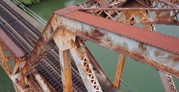
Bridge Inspection
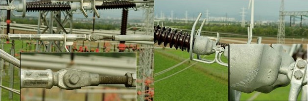
Hydro Infrastructure Inspection
Close up and detailed images can show a great deal and UAV flights can cover al lot of structures efficiently with a minimum of mobilizing costs. Managers can use the imagery to plan more extensive maintenance efforts if required.
Security and Law Enforcement
Our UAV services offer high operational readiness for first response, situational awareness, remote sensing (e.g. thermal imagery and chemical sensing), accident reconstruction, and more. We can provide airborne monitoring and surveillance.
If you are restricted from operating third party services or are required to have your own personnel working on a project, you can also rent our equipment or purchase a system.
Surveillance
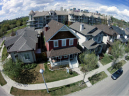
Real Estate
Aerial views of real estate give potential buyers an otherwise complete full colour HD video or 4K picture of a property. Flights taken within built up areas require the approval of Transport Canada through the application of a Special Flight Operations Certificate
Aerial Marine Images
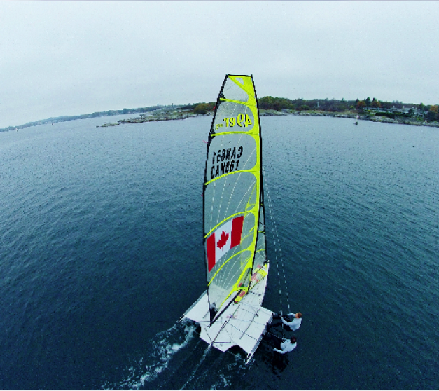
Aerial Marine Images
Aerial Cinematography
Drones are more cost effective than hiring a full scale helicopter or aircraft platform, so you can either keep your budget down or achieve much greater aerial coverage for your money. They are also much less disruptive to production.
UAS Applications
Applications for UAS and photogrammetry are only limited by people’s imagination, new applications are being developed daily. Here is a list of applications that these systems have been used for.
Professional Surveying
• 3-D Mapping
• Open pit mine surveys
• Aggregate and mine stock pile measurement
• Monitoring oil and gas pipelines
• Volume measurements of extractions
Natural Resource and Agricultural Monitoring
• Waterways in flood management, surveying and mapping flood plain areas
• Forestry aerial imaging and operations monitoring
• Fishery habitat assessment
• Crop performance assessments
Infrastructure Inspections
• Telecommunication tower inspections
• Hydro tower inspections
• Bridge inspections
• Dam inspections
• Roof inspections
Search, Rescue and Recovery
• Land and water search and location
• Forward looking infrared radiometers (FLIR cameras) can be used to find heat signals in remote locations
• Search for missing persons
Surveillance
Property surveillance
Accident Reconstruction
Precise high-resolution imaging and centimeter accurate positioning of motor vehicle accident scenes
Disaster Management
• Disaster effects assesment
• Detailed imagery and positioning of crash scene attributes
• Monitoring and measuring disaster sites too dangerous for personnel
• Disaster rehabilitation planning
• Disaster damage estimation
Marketing
• Cinematography
• Showcase Real Estate
• Aerial photography, e.g. city, urban and rural landscapes
• Advertising
Source: http://advanteck.ca/uas-system/uas-services/
Magazine
No information