Control System CA Inc.
UAV Photogrammetry
We map all inaccessible areas – with higher resolution.
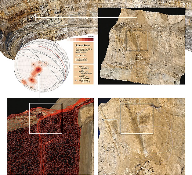
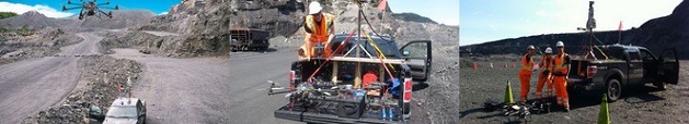
Control System has developed a ground-breaking solution for rock mass structure mapping, which combines the benefits of both UAV photogrammetry and ground-based LiDAR to deliver dependable higher resolution results, faster and considerably cheaper than traditional survey methods. UAV photogrammetry provides high-precision data from areas such as rock slopes and overhangs etc., which due to inaccessibility cannot be mapped in such detail with ground-based LiDAR.
UAV photogrammetry also complements the geometric precision of data from LiDAR scanning by providing image data from optimal survey points above the ground.
UAV photogrammetry also complements the geometric precision of data from LiDAR scanning by providing image data from optimal survey points above the ground.
• Map all inaccessible areas of your open pit mine
• High -density texture mapping with up to 1 millimetre resolution
• Rapid deployment and scanning
• Multiple UAVs for faster mapping of large sites
• Post Processing results deliverable within up to 24 hours(depending on size of area mapped)
• Textured mine models delivered in Wavefront.obj, and. vrml.(ADAM Technologies ready).
Source: http://www.controlsystem.ca/?uav-photogrammetry,11
Magazine
No information