CatchPoint
|

Location and Licenses
| Central Coordinate 122° 28' 57.6" W Longitude 52° 38' 22.2” N Latitude |
| 2 cell tenure – 39.24 hectares (96.92 acres) |
| Price: $ 2,878 plus 5% royalty |
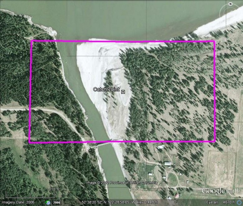
The CatchPoint placer tenure is situate within the Cariboo Mining District, 37 kilometres South of Quesnel, or otherwise, 57 kilometres north of Williams Lake. The property comprises the northern graveled point of Diamond Island, cradled within a large “S” bend on the West side of the Fraser River, immediately adjacent to (West of) Alexandria. Lying to the East of the Fraser Fault, the claim is underlain by sedimentary rocks, and bounded on both sides by volcanic rocks. Diamond Island is separated from the main land mass on its western flank by a channel along the Fraser, measuring 50 metre width within the tenure area, to slightly over 100 metre width approximately halfway throughout the channel’s course. The main channel of the Fraser flows around the Eastern parameter of the island. The course of the Fraser River approaching the island serves a unique set of controls, whereas over the course of this :”S” bend, the current is forced against one embankment thence deflecting to the opposite side, several times. Immediately preceding its flowage on its approach of said channel, the River’s course makes an abrupt 90° turn to the East, thus propelling the flowage head-on into the Western embankment, reducing the current’s energy, and thus facilitating opportunity for heavier minerals to abandon their former migration route, resulting in the gravel buildup at the apex of said channel. This being one of the unique occasions where placer minerals accumulate on the outside bend of a watercourse. However, in light of the open channel, this affords sufficient draw toward the channel, resulting in the buildup of gravels at the point of this island – which equates to enhanced opportunity for placer minerals to accumulate there.
While only limited pan sampling had been conducted during the 2004 field program, the results warranted the area’s eventual staking, however, the extent and distribution of placer minerals was not determined at that time. The annual rise and fall of the Fraser River refreshes with new deposit.
Access to the claim area (from the North) is gained by taking West Fraser Road from the West end of the bridge at Quesnel, thence traveling southward to the Diamond Island turn, thereafter, a further 2.6 kilometres to the western boundary of the claim, or otherwise, 3.1 kilometres to the east end of the bridge crossing over said channel. Access from the South would be easiest via the Ferry, situate off Highway 97 approximately 3 kilometres North of Marguerite (leading across the river to Castle Rock) or otherwise via the West Fraser Road leading North (along the West side of the Fraser) from Williams Lake.


