SodaShoal
|

Location and Licenses
| Central Coordinate 122° 17' 20.1" W Longitude 52° 20' 22.1” N Latitude |
| 2 cell tenure – 39.50 hectares (97.56 acres) |
| Price: $ 2,879 plus 5% royalty |
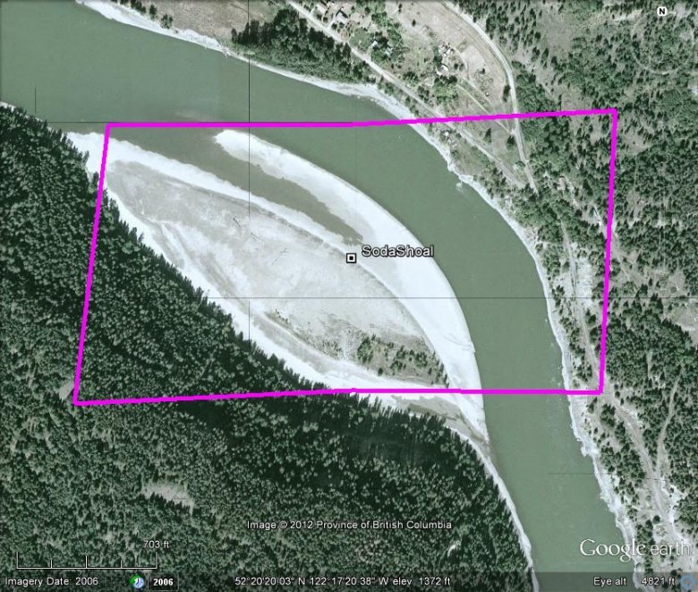
The SodaShoal placer tenure occupies a unique inside bend on the west side of the Fraser River, opposite Soda Creek. The land mass itself formed a concave in the shoreline, creating added facility for gravel and coble to buildup along the shoal area. During Spring freshet this bar is mostly underwater, in later Summer, Fall and early Spring, when the water level has receded the shoal becomes exposed, offering over 770 metres in length by 330 metre width of workable beach. Sampling conducted along the West side of the Fraser River during the 2004 field program, included a brief stop along this area for pan sampling. The results thereof, were more than favorable, leading to the eventual staking of this claim.
Access to the property is gained via Williams Lake, taking McKenzie Avenue North to its intersect with the W. Fraser Road, thence following said W. Fraser Road for a distance of 18.4 kilometres to the Rudy Johnstone Bridge crossing the Fraser River, thereafter traveling a further 2.9 kilometres on the Stack Valley Road to its intersect where the W Fraser Road resumes, thence continuing along the W. Fraser Road to where a pit road enters at co-ordinate 122° 18' 36.9" W Longitude 52° 20' 03.6” N Latitude, for an accumulative distance of 9.8 kilometres from said bridge. Following said road to the pit, thence traveling around the left side of same to continue onward to its terminus close to the shoreline of the Fraser River and the tenure area.


