Mining Claims
High Ender
|


Fraser River Gold Claims For Sale
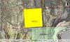
Articul Tenure #525962
Location and Licenses
| Central Coordinate Longitude 121° 34' 46.1" Latitude 50° 07' 22.2" |
| 1 cell - 20.716 hectares (51.19 acres) |
| Price: $ 2,100.00 |
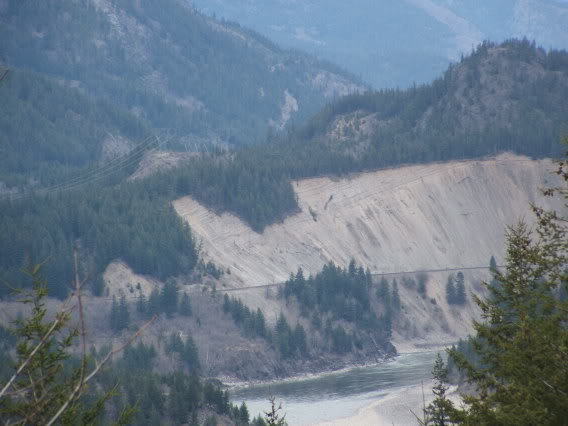
The above noted claim represents one of the more dynamic placer prospecting properties along the Fraser and offers excellent potential. Overlying an old channel on a major river bend on the Fraser River, this property is situate only 13 kilometers south of Lytton or, 31 kilometers north of Boston Bar. Locally, during early earth-forming periods, a massive intrusive body of granitic rock became uplifted, forming the current structure we now recognize as the 'Kanaka Mound.' Following this up-evil, the entire geographical area fell subject to the glacial period, the latest of which (eleven thousand years ago) left a sheet of ice thousands of feet thick. As this glacier began to melt, waters commenced to flow in a more southerly direction, scouring and gouging out the underlying land mass. As water levels rose to unprecedented levels, this intrusive structure then became a submersed mid-stream mound. Following thousands of years of battering from the torrents of such natural forces, and as water levels began to recede, the 'mound' then became a natural trap for alluvial matter. Giant crevices became filled and, sand, clay and gravels began to accumulate on the lee side of the 'mound,' and likewise on the lee side of the natural bedrock bridge adjoining the 'mound' to the land mass on the west side of the river, thus creating an upper channel which eventually filled as the river slowly receded. These dynamic chain of events thus carved out one of the more spectacular placer properties to be had.
Commodities common to the area, include fine to nugget size gold and platinum, jade and non-precious gem stones. Research suggests the likelihood of an ancient channel deposit where waters once crossed the upper bench on the west side of the 'mound.'
In that this is not a waterside property, the prospecting/recovery season should be applicable from March to November, with the spring high water season occurring late May to June. While systematic sampling would be the first order of business, it is perceived this property would support a machine operation. Water, however, would be required to be trucked in for a recirculating system.
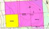
The Kanaka tenure, as listed above, would be best accessed from the west side of the river, through crossing the Fraser by ferry at Lytton, thence traveling south along a gravel road and following the power line as it more-or-less parallels the Fraser. During summer months, the properties may also be accessed from the south, via the Nahatlatch Road, a good two lane gravel road leading north from North Bend (Boston Bar), to where the road crosses the Nahatlatch, thence through taking a slightly rougher yet passable road, to the claim area. The northern and southern points of entry to the claim areas are as follows: from the north, entering the southwest corner of the Gems Too claim, Longitude 121° 34' 34.6" Latitude 50° 07' 45.9"; and from the south, at Latitude 50° 07' 45.9"
Similar Properties


